The Geography of the Koreas
A geographic exploration of North and South Korea, including its location, climate, production and how Korea perceives herself.
Location and Landscapes
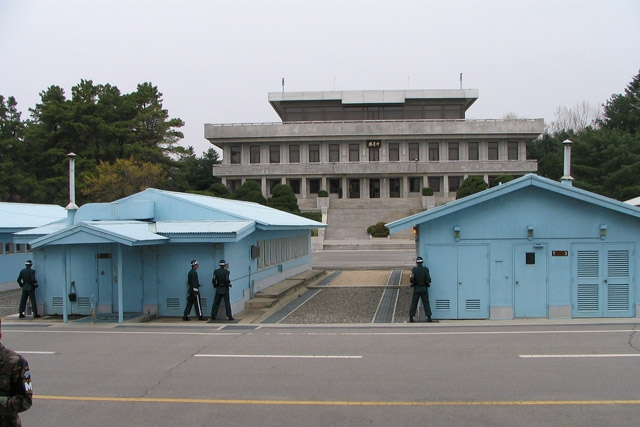
An extension of the eastern side of the Eurasian continent, Korea is a relatively small though prominent peninsula. One can easily locate Korea on a world map or globe by following 127º east meridian north from the equator to the middle latitudes. Note where this meridian intersects with the 38º north parallel. That exact intersection is located near the heart of the Korean peninsula. It is also quite close to an important geopolitical feature called “the demilitarized zone,” or DMZ. The DMZ is a temporary political boundary formed by the Korean Armistice of 1953, which ended the hostilities of the Korean Conflict (1950–53). The Korean Conflict began as a civil war, expanded into an international conflict fought on Korean soil between communism and capitalism, and has yet to be resolved after almost fifty years under an uneasy truce.
The DMZ divides the peninsula by separating North Korea (Democratic People’s Republic of Korea) from South Korea (Republic of Korea). The DMZ is 2.4 miles wide and centers on a demarcation line that extends for 151 miles between the Yellow Sea and the East Sea (or Sea of Japan). The DMZ represents a strange combination of peace within tension. There is peace within the zone because it is “demilitarized” and “off limits” to soldiers and civilians: that means plants and animals inhabiting the zone are protected from humans. Yet, there is an uneasy tension between the opposing combat-ready forces of North and South who still face and intimidate each other across the zone.
At present South Koreans call the peninsula Hanguk, while North Koreans call the peninsula Choson. South Korea divides itself politically into nine provinces and six special cities. North Korea divides itself politically into nine provinces and three special cities.
The Korean peninsula is about 600 miles long, but at its shortest width (near the DMZ), it is only 120 miles from coast to coast. Many South Koreans, especially younger ones, describe their peninsula as “tiger-shaped.” The tiger is a traditional symbol that drives away misfortune, but it also represents the urban and aggressively successful modern South Korean economy. Other Koreans, especially older ones, still think of the peninsula as “rabbit-shaped.” The rabbit represents the wisdom of the peninsula’s traditional agricultural economy, which is rapidly becoming a memory. Both the tiger and rabbit appear in many Korean folktales and paintings and even on South Korean exports.
At nearly the same size and latitude as the state of Utah, the entire landmass of the Korean peninsula measures 84,565 square miles. The DMZ division allocated more territory to the North (47,541 square miles) than to the South (38,024 square miles). However, in 2000, the population in the South (est. 46,000,000) far exceeded that of the North (est. 24,300,000).
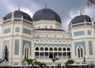
Just south of the DMZ, in vulnerable proximity to North Korean military forces, is Seoul, South Korea’s capital. The fourth-largest urban center in the world, Seoul has crowded, bustling, streets, skyscrapers, subways, industries, grime, smog, and almost ten million inhabitants, most of whom live in lofty apartments that resemble thousands of beehives surrounding the central city. To the north of the DMZ (and at a safer distance from South Korean military forces) is the city of Pyongyang, the moderately sized and meticulously clean capital city of North Korea. Both of these cities are located near the western coast and along rivers that flow into the shallow Yellow Sea. Indeed, most urbanized areas on the peninsula are located along or near the highly indented western and southern coasts, where there are numerous fishing villages and vast tidal flats. Modern Korean engineering and ingenuity have overcome many natural obstacles to ocean commerce along the shallow coast of the Yellow Sea. Artificial ports are crucial to the productive agricultural and industrial economies of large concentrations of inland populations, like those of Seoul, Taejon, and Kwangju. There are wide coastal plains in the southwest. Mokp’o, a large city and port near the southwestern tip of the peninsula, is threshold to a vast archipelago of thousands of islands and islets. The archipelago region extends eastward from Mokp’o, past the naval port of Chinhae, to Pusan.
In contrast to the serrated Yellow Sea coastline and southern archipelago, the peninsula’s eastern seaboard is generally uniform with extensive unprotected coastlines. Except for the extreme northeast and southeast coasts and river valleys, the East Sea coastal plains are narrow and relatively unpopulated. Although East Sea coastal waters are much deeper than those of the Yellow Sea, there are few natural deepwater ports. Even the harbors of Pusan, Ulsan, and P’ohang in the South, and Wonsan in the North, are more engineering miracles than gifts of nature.
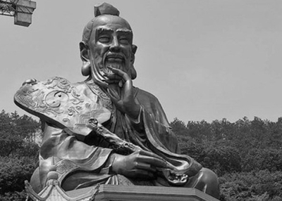
The poetic interpretation of the word Korea—“Land of High Mountains and Sparkling Streams”—derives from the word Koryo, the name of an ancient kingdom on the peninsula. Mountains and streams are indeed the dominant characteristics of Korean terrain. Korean artists over the centuries have tried to capture the peninsula's dramatic landscapes of peaks and valleys in their paintings. There are so many mountains on the peninsula that only onefifth of the land can be cultivated. The rest is too high or steep. Most of the mountainous terrain is located north of the DMZ, where there are few arable (farmable) plains. The few remaining dense forests are located in the far north. These rugged regions are sparsely inhabited and mountain dwellers often live isolated lives in dispersed hamlets. Although the highest mountain chains are found in the far north, they also extend southward, running parallel and close to the peninsula’s eastern seaboard.
More farmable lowlands and river valleys are found in the south and west, where populations are larger and highly concentrated. The only major inland city is Taegu, in the south. The highest Korean mountain is Paektu (“No Head”) Mountain, a magnificent ancient volcanic landmark. A rugged riverine boundary between North Korea and its neighbors, China and Russia, is formed by the diverging flows of the Amnok (Yalu) and Tuman Rivers from their sources near Paektu Mountain. North Korea's border with China is 640 miles long, but its border with Russia measures only ten miles. The highest mountain in South Korea is Halla Mountain, a volcanic peak at the center of Cheju Island. It is located about 90 miles south of Mokp'o, across the Cheju Straits. Halla Mountain can be translated into English as “The Peak that Touches the Milky Way.”
The Korean peninsula, together with many of its southern offshore islands, forms a nearly complete land bridge from Chinese Manchuria (in the northwest) to Japan (in the east). The southern tip of the peninsula is only about twenty miles from Japanese territory. Korea’s strategic location between China and Japan explains a great deal about the political, economic, and cultural history of East Asia.
Climate
Although relatively small, Korea has a surprisingly diverse climate. One of the outcomes of the peninsula's mid-latitude location is its seasonal climate. There are very distinct temperature and moisture patterns for each season.
Spring is short and characterized by the sudden onset of warmth, melting the snow of the long, cold Korean winter, particularly in the north. As the snow melts and harsh March winds subside, the brown hills and plains suddenly turn green. The rainy season begins in late June or early July. Summer is very hot and wet, particularly in the southern half of the peninsula. These conditions are typical of a summer monsoonal East Asian climate. Monsoon is an Arabic word meaning “seasonal wind shift.” During the summer drifting masses of moist air move inland from the Pacific Ocean toward Russian Siberia. During the winter the winds “shift” to the opposite direction.
Annual late summer storms called “typhoons” also can bring torrential rains and powerful winds, causing floods, landslides, and extensive damage to property and crops. The end of the typhoon season coincides with the onset of fall. The reverse monsoon drives the moist air back out to sea, and cool, dry air masses out of Russian Siberia make skies increasingly clear. Fall is short and delightful, both clear and colorful, but the winds grow bitter cold again too soon. The increased cloudiness and snowfalls of the long Korean winter return.
The seasons do not manifest themselves in the same way everywhere on the peninsula. Because of the peninsula’s north-south orientation, the differing heights and positions of mountains and plains, and the varying distances of inland locations from the surrounding seas, seasonal conditions can be very different in various areas. For example, January at the snowless foot of Halla Mountain on Cheju Island is much milder than January at the snowbound foot of Paektu Mountain in North Korea.
Resources
Despite a fair diversity of natural resources, Korea’s human resources are often described as the most valuable. This was true in traditional agricultural times, as it is in the modern industrial age.
Clean water and wood for fuel were readily available to support agricultural productivity throughout most of Korea’s history. Forests were once thick and wildlife abundant. Also, there was always an array of ocean resources to help provide for nutritional needs. However, many of these resources have been depleted as Korea has modernized and become more densely populated. In this case more human resources are a mixed blessing. The economy prospers while the environment suffers. Environmental quality has especially deteriorated in South Korean cities such as Seoul and Pusan, which are full of high-rise apartments and automobiles. Air quality has declined with excessive auto emissions. Even in the countryside there are increasing pesticide drifts that poison the air. Korea's important freshwater and ocean resources are damaged by overexploitation, toxic runoff, and siltation.
The natural soils of Korea’s mountainous terrain are poor. Yet many centuries of careful cultivation and fertilization by traditional farmers have brought significant improvement. Today special chemical fertilizers and pesticides are widely used in plant cultivation, and traditional varieties of rice have been replaced by genetically engineered rice almost everywhere. Slightly more arable land is available in the South (19%) than in the North (14%), but food production, transportation and the exchange system in the South is much more efficient than in the North. However, agriculture no longer constitutes the major sector of the economy of either South Korea (only 8%) or North Korea (only 25%). Both are now industrial and/or service economies, and their resource needs have changed dramatically.
Urban-industrial economies have tremendous energy needs. If the domestic energy resources essential to economic growth are lacking, they must be imported. For example, Korea lacks petroleum resources. In South Korea the export of manufactured goods from light industries pays for petroleum imports to support modern manufacturing industries and transportation networks as well as to satisfy residential and commercial demands.
Fortunately, the peninsula’s many rivers and streams also have been generous producers of electrical energy for urban-industrial growth. In addition North Korea has had plenty of coal and iron as well as other minerals (lead, tungsten, zinc, graphite, magnetite, copper, gold, pyrites, salt and fluorspar) for industrial development. South Korea has coal (and some tungsten, graphite, molybdenum, and lead) but must import iron ore to support its heavy industries. Nuclear power plants have also been built in both North and South Korea to help offset insufficient energy resources.
With South Korea's recent “miracle” economy, its Gross Domestic Product (GDP) is fifteen times greater than that of North Korea. South Korea’s successful economic strategy is due to: 1) increasing the output of export industries while limiting the import of consumer goods and 2) pushing the labor force to work harder and sacrifice more. Unlike South Korea, which is a major player in the global capitalist economy, North Korea continues to adhere to communism and economic self-sufficiency. The result is lower living standards and slower economic development. Recent reports have indicated that there may even be widespread malnutrition and starvation in North Korea.
Conclusion
Korea’s history has been quite dramatic. From its ancient beginnings, scattered groups of continental hunting and gathering peoples formed at land’s end into a distinctive culture. Their clans, tribes, and kingdoms eventually grew and mixed into what is now globally recognized and respected as a rich, populous, and prosperous civilization. South Korea has been especially successful in developing its industrial-economic potential to the point at which it is now a major player in the global economy.
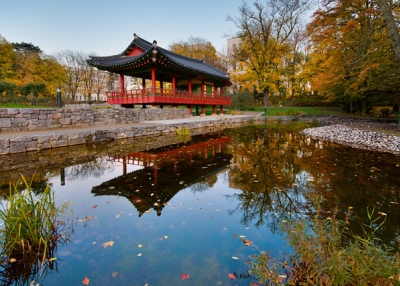
In general, and throughout most of their history, Koreans have led productive lives while enjoying the attractiveness and serenity of their peninsular homeland, which they still refer to as “The Land of the Morning Calm,” even though the roar of South Korea's “tiger economy” is now heard around the world.
Author: David J. Nemeth.