Understanding the Geography of China
An Assemblage of Pieces
This background essay introduces the diversity of China's natural and man-made features, as well as the relative population of its various areas. Used as background information, learners can explore the many different uses of maps (see related lesson plans). Road maps to find our way to other places. Physical maps show different landforms and elevations and bodies of water. Historical maps help us understand political boundaries and the movement of people, goods, and ideas. Military leaders need maps as they plan their campaigns, and tourists need maps in order to figure out interesting places to visit. Many maps show both natural and man-made features. They often reflect values of the people who create them and define their place in the world. Maps were used for military and political purposes and show how China viewed itself in relation to the rest of the world. In China ownership of a map indicated sovereignty over the land it depicted.
Understanding the interaction between a natural environment and various human and cultural patterns is an essential aspect of geography. To fully appreciate China's broad geographic and cultural diversity, one needs to identify general characteristics that act as guidelines. The technical term used to describe distinctive areas is "homogeneous regions." Today "fingerprint" carries the same idea, namely some thing or place that is distinctive. Just as fingers share general characteristics, each has a unique "print" or pattern. This same principle can be used to facilitate understanding complex cultures and societies, such as those in China.
A distinct geographic print might include the following variables: physical and environmental features, such as climates, soils, topography, and location; historic patterns and their relationship to the natural environment; the economic activities and resources that define the area today.
An aid to creating an understanding of the nature of such fingerprints would be tables showing each region's common (yet distinctive) characteristics. An important characteristic is vernacular housing (houses built without architects and that reflect local materials and conditions), but today many people live in apartment buildings, especially in urban areas. Social organization, transportation, and food are other important aspects of a fingerprint.
The North China Plain
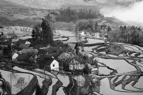
Physical characteristics: As its name indicates, this is an area of gently rolling topography. It is subject to flooding, and water often stands in large pools and "lakes," as there is no place for drainage. This creates marshes and shallow, reed-filled lakes, which are good for thatching and weaving as well as migratory birds, fish, and snails. Winter and summer temperatures can be extreme, and dust storms are common. Highly variable weather means good harvests for only three out of every five years.
History: The North China Plain was one of the cradles of Chinese civilization. China's earliest agricultural societies as well as dynasties formed there. People traditionally lived in dispersed communities rather than nucleated settlements because food and water were available everywhere. The primary need to nucleate was as a defense against invaders and raiders. The earliest archaeological sites of "cities" are at the foot of the Taihang Mountains, where there are minerals as well as manageable water resources for all seasons.
Economic activities and resources today: Even today the North China Plain is a land of dispersed agricultural settlements. There is little or no industry other than distinctive indigenous handicrafts. Fresh water must come from wells that often are salty because of poor drainage. The lack of topographic relief means seasonal winds are strong and often destructive. The result is that many areas have planted windbreaks to protect the soil of the fields from erosion. Life on the North China Plain is one of self-sufficiency and subsistence. Wheat, cotton, tobacco, peanuts, persimmons, and other seasonal fruits and vegetables are grown there.
Housing: mud-based, single-story structures with flat roofs
Social organization: villages and clans
Transportation: walking, wheelbarrows, bicycles, cars
Food staples: wheat-based foods
The Loess Plateau
Physical characteristics: The overwhelming distinctive characteristic of the Loess Plateau is the wind-blown alluvium (dust) that has accumulated to depths of over 1,000 meters (3,300 feet) in some places and is known as loess. While loess is rich in calcium and thus fertile, the overall aridity of the region coupled with the fact that loess does not hold water makes traditional methods of irrigation and farming useless. Environmental conditions, including highly variable rainfall (when it does occur), means that farmers seldom expect to harvest more than two crops every three years.
History: Two cultural patterns resulted from the physical environment and location of the Loess Plateau. One was human poverty and isolated communities; the other a dependency upon trade with nomadic peoples and the empires beyond the Great Wall. Economically the Loess Plateau has been dominated by trade and commercial cities that have flourished and died as routes and the direction of trade have shifted. It has never been a strong food-producing region.
Economic activities and resources today: As in the past, key cities in the Loess Plateau are those that facilitate trade and transport to and from eastern China and the North China Plain. Cities such as Xi'an and Lanzhou are trade hubs stemming from a reinvigorated economy in Xinjiang and the former Soviet countries of central Asia. Today, however, oil has replaced silk as the major economic commodity. Oil is a major resource in Gansu, Xinjiang, and the contiguous country of Kazakhstan.
Housing: caves carved into the loess cliffs and mud-brick houses in rural areas, apartments in urban areas
Social organization: nuclear families
Transportation: walking, mule, and horse in rural areas; cars, buses, and bicycles in urban areas
Food staples: wheat-noodles and sour cabbage
The Southeast Coast and Shanghai
Physical characteristics: This region shares the entire Yangzi Valley's dominant characteristics of water, wetlands, and hot and humid summers. However, the influence of the Pacific Ocean as well as access thereto make the area distinctive. The ocean's warm current creates milder winter temperatures than in the interior. In addition the nearby mountains (Huangshan and Wuyi) are favorable for crops other than aquaculture (rice, shrimp, ducks, and so on), which is prominent in the lowlands. Mild climates and abundant rainfall mean farmers in this area generally expect to obtain three or more crops every year. Some form of food, whether from land or sea, is always abundant and in surplus.
History: This was the first region to feel the impact of the West through the Opium War and "Treaty Ports" of the eighteenth century. It has had the greatest number of Christian missionaries, Chinese Christians, and Christian churches in China. Like so many of China's distinct physical environments, it is dominated by ethnic peoples not fully identifiable as "Han," who speak distinct languages and often have closer ties to Chinese overseas.
Economic activities and resources today: Shanghai is the major city of this region. Located at the mouth of the Yangzi, it is a thriving port and a center for steel, telecommunications, automobiles, power production equipment, petrochemicals and electric appliances. Having a strong service industry, the city is also focused on finance and insurance, commerce, real estate, tourism, and information. On the coast fishing and shipping are important industries. Other cities along the coast also have been designated "special economic zones." In the interior regions rice is an important cash crop, except in the mountainous areas, where fishing and forestry take place. Other specialty crops, such as tea and citrus fruits, are grown, but the coast is subject to typhoons.
Housing: plaster or brick to offset rain in rural areas, apartment buildings in urban areas
Social organization: class, family, or business compounds
Transportation: boats and ships on rivers and canals, cars, buses, and bicycles
Food staples: rice, seafood, and tropical fruits
The Yangzi Valley
Physical characteristics: Separated from other regions by mountains and extensive wetlands is the Yangzi (Yangtze or Changjiang-"long river"); its tributaries and lakes are the focus of life and economics in the valley. Summers tend to be hot, humid, and rainy along the river, while winters are brief but cold.
History: The Yangzi Valley has traditionally been an important food producer. The river has been the center of economic life, bringing trade and influences from distant places. During the twentieth century, initiatives to dam the Yangzi have brought about drastic changes in the landscape, economy, and lives of the people living in the Yangzi Valley, forcing many to relocate.
Economic activities and resources today: Fishing and boat commerce dominate life and culture. Cities, such as Chongqing (in Sichuan province), Wuhan, and Nanjiang, are driven by economies tied to water-borne transportation and commerce-not agriculture or even food processing. Major manufacturing centers exist along the river because it is a cheap means of transport. There are large numbers of people who spend their entire lives on small or medium boats, making a living moving goods and people via the numerous lakes, canals, and rivers of the entire Yangzi valley.
Housing: white-plastered, multistoried houses with black tiled roofs, houseboats, apartments in cities
Social organization: commercial/trade "families"
Transportation: river and canal boats, trucks, cars, bicycles in cities
Food staples: rice and fish
The Sichuan Basin
Physical characteristics: The defining physical feature of this region is the large Sichuan Basin, which is divided into two parts, Chengdu and Chongqing. High and difficult mountains surround the basin. Primary access to eastern China is via the Yangzi River, which traverses the famous Three Gorges. This geographic setting creates a mild climate. Extremely fertile soils are largely derived from old lake sediments. Farmers not only can count on several crops every year, they can depend on a diversity of food crops as well as specialties.
History: It is often said that "Sichuan in the first province to declare independence and the last to be reunited after there is peace." Located in a highly protected, productive setting and adjacent to virtually every major region of historic China, Sichuan is capable of being wholly independent from the rest of China. Yet, control of Sichuan and its agricultural riches provided access to every other major political and economic realm, making it the target of many outside warlords and emperors.
Economic activities and resources today: Sichuan has always been known for its tea, silk, flowers, medicinal herbs, and diverse wildlife, including pandas, deer, and tigers. These resources remain a major staple of its modern economy as do the raising of sheep, pork, and grain. Tourism is also crucial to Sichuan's economy. Popular tourist sites include the Thousand-Buddha Cliff, Qingcheng Mountain, the Bamboo Forest, the Corridor of Cypresses, Woolong Nature Reserve (for panda conservation), and Xiling National Forest Park. The Yangzi River is a thoroughfare of trade, meaning that Sichuan is rapidly changing with the influx of foreign investors and developers.
Housing: timber, stone, or straw houses in rural areas; large apartment buildings in the cities
Social organization: village clusters in rural areas
Transportation: walking, mule, horses, in the mountains; bicycles and cars on the plains, boats on rivers
Food staples: varied
Southwest Uplands
Physical characteristics: Nothing so dominates and defines southwest China as its rugged, highly eroded topography. Because it is close to the tropical cyclones of the Bay of Bengal and the South China Sea it has abundant rainfall (often causing erosion or denuded slopes). This location and terrain create numerous distinctive local "niches" that often are self-sufficient, which in turn support an abundance of distinct ethnic groups, many of which also live in the neighboring countries of Laos, Vietnam, Burma, and even Thailand.
History: This region first came into the Chinese sphere during the Mongol Yuan dynasty (1279-1368). Its history reflects both its rugged topography as well as its proximity to the modern countries and peoples of southeast Asia, such as Vietnam, Laos, Thailand, and Myanmar (Burma). Trade between these countries and the Southwest Uplands often has been illegal and generally consisted of small items of great value, such as jade or opium.
Economic activities and resources today: Land for grazing and the cultivation of rice, winter wheat, tea, and beans is available in the region. The tropical plateau along the border of Vietnam and Laos is ideal for cultivating rubber and bananas. The mining of tin, another major industry of this region, is the only distinctive economy that is both traditional and modern. More valuable, however, has been the cultivation and export of opium, an activity developed as a result of Britain's Opium War with China.
Housing: caves carved into the loess cliffs and mud-brick houses in rural areas; apartments in urban areas
Social organization: nuclear families
Transportation: walking, mule, and horse in rural areas
Food staples: vegetables, rice, ducks and geese
Xinjiang
Physical characteristics: China's largest province is a landscape of deserts, mountains, and oases. Most of the region is dominated by the Tarim Basin, which is filled mostly by the formidable Taklamakan desert and rimmed by high mountains-the Kunlun Shan to the south, the Karakorum to the west, and the Tian Shan to the north. The alpine beauty of the Tian Shan separates the Tarim Basin from the smaller Junggar Basin, which is characterized by more moisture and grass.
History: The inhabitants of the Junggar Basin have a long association with various Mongol peoples, but they are more pastoral than nomadic. Located between the cultural empires of China in the east and central Asia in the west, Xinjiang was an important historic link along the Silk Roads. The peoples living along oases around the rim of the Tarim Basin had closer ties to Persia and the Islamic influences of the Middle East. The Uighurs, Xinjiang's largest minority, are predominantly Muslim and Turkic in ethnicity and language. Their economic history is more closely linked to the mercantile cities and trade of the ancient Silk Road than to the irrigation practices of eastern China. The trade and traffic along this famous route integrated people and cultures and introduced distinctive styles of music and musical instruments, especially the suona and pipa, or Chinese-style lute. The beginning of the twentieth century found the British, Germans, American, Japanese, and Russians vying for control of this strategically important location.
Economic activities and resources today: Xinjiang is rich in oil. The Taklamakan is too barren for agriculture but is often used as a nuclear test site. Despite the fact that the railroad does not extend very far west into the province, tourism is gaining in this remote region of spectacular scenery with a wealth of archaeological treasures, including Buddhist cave temples, ruined cities and fortresses, petrogylphs, and 4,000-year-old mummies.
Housing: earth/adobe houses, two-storied with flat roofs. Nomads live in tents, while apartments are common in urban areas. Mosques and some residential architecture have Central Asian or Persian-style influences.
Social organization: nuclear families in urban areas; groups of families for nomads
Transportation: long-distance trucks and buses in rural areas; bicycles within cities. Mules are used in cities, and horses and camels in rural areas.
Food staples: wheat noodles, flat wheat bread (nan), and mutton
Northeast (Manchuria)
Physical characteristics: The dominant physical feature of this region is its winter cold and ice. Equally distinctive and important are its two extensive wetlands-the northernmost associated with the Songari River and the southern with the Liao River. Nevertheless, its basic natural resources of iron ore and coal have made it economically vital to the rest of China.
History: The Manchus invaded China in the seventeenth century, establishing the Qing dynasty in 1644. The lands of Manchuria, however, were not open to Han settlement until the dynasty's end in 1911. Most Chinese migrants worked in existing industry and on large commercial farms producing mostly soybeans and corn.
Economic activities and resources today: Manchuria is China's most important region for heavy industry. Coal and iron mining are also central to the region's economy, and ginseng, soybeans, and timber are major products.
Housing: caves carved into the loess cliffs and mud-brick houses in rural areas; apartments in urban areas. Some Russian influence in the architecture.
Social organization: nuclear families
Transportation: walking, mule, and horse in rural areas
Food staples: meat and soybean curds
Qinghai and the Tibetan Plateau
Physical characteristics: Altitude, which can average 3962.4 meters (13,000 feet), best defines the physical environment of the Qinghai-Tibetan plateau. Except in the bright sunlight, it always is very cold. Located mostly in the rain shadow of the Himalayas, the region is arid to semi-arid. This means that despite a latitude close to the Tropic of Cancer, Qinghai and Tibet are nontropical for the most part. Still, there are areas along its southern and western boundaries, where rhododendron and banana trees grow in the shadow of active glaciers. This is attributable to the heavy rainfall and temperatures associated with the Indian monsoon.
History: Because of the region's adjacence to India and central Asia, the people, economies, and even religion of Qinghai and Tibet have seldom been affected by those of China in the east. Even Mongolia had closer cultural links to this region than did China proper. Animal husbandry and nomadism are traditional ways of life. Until the 1950s, one out of every five Tibetans was a Buddhist nun or monk. Monasteries have been at the center of society since at least the eighth century.
Economic activities and resources today: Qinghai and Tibet remain remote and largely unpopulated. Where conditions permit, the Chinese have encouraged the westward migration of farmers from overpopulated areas to the east. Animals continue to be raised, and wool weavings are another important product. Goods are also produced from indigenous gold and turquoise.
Housing: nomads live in yak-felt tents. Homes are two stories with inward-slanting mud, earthen, brick, or stone walls and earthen floors.
Social organization: monasteries play a role in Buddhist communities, mosques in Islamic ones. Nomads gather in family clusters.
Transportation: walking, caravans, trucks and buses, horses in rural areas; bicycles and cars in urban areas
Food staples: yak butter, tea, barley, vegetables, yak, or lamb
Tying It All Together: From Empire to State
Clearly, to create political "China," it is still important to tie these different regions together. Transportation remains the most crucial factor. As the means of tying the country and its regions together proceeded, a common written language and shared cultural values evolved. The written language and the bureaucratic class that used it were pivotal in creating a net of a shared experience and cultural values that bonded the disparate geographies and spoken languages of China and linked the past to the present.
Because the origins of China's empire lay in its interior, imperial highways were initially the most important features of the transportation system. The network of imperial highways was first established by Qin Shihuangdi (258-210 B.C.E.), who united the kingdoms of China in 221 B.C.E. He also initiated the construction of a canal system. By the Song dynasty (960-1279 C.E.), canals linked the lower Yangzi Valley and regions south of it to the North China Plain. Natural lakes and rivers also helped unify the Chinese Empire, with the Yangzi and its tributaries tying together coastal and interior regions. Except in Qinghai and the Tibetan Plateau and Xinjiang, an extensive rail system links China and is the most common form of long-distance travel.
One cannot underestimate the importance of television and telephones as well as the airlines in promoting the Chinese view of themselves as one people and culture. Their value in political control was demonstrated in 1989 when televised "wanted" posters were broadcast instantaneously throughout China, and in June 1997 when the reunification of Hong Kong became an ethnic rallying point. The images and issues were simultaneously shared with Han Chinese throughout the People's Republic as well as in other parts of the world. The Internet is gaining popularity, though chiefly in urban areas. However, the central government is fearful of its inability to actually monitor and control such communication.
Political Organization
Political organization has been as important in creating a common culture. No empire or state can exist without both cooperation and means of enforcing order among disparate geographic areas and peoples. This was the primary achievement of Qin Shihuangdi. This first emperor defined the empire's borders within central Asia and established common laws for everyone within every geographic sector of the country. In modern times the reunification of China's geographic regions (often historically independent kingdoms or "states") under a common Communist ideology was a major achievement of the Chinese Communists and the People's Liberation Army.
Political organization in China has been successful in part because it recognizes the distinctiveness of various geographic areas. Large cities, such as Shanghai, Beijing, Tianjin, Chongqing, and Hong Kong, have special political status. Likewise, key economic cities have been created and accorded such status to provide controlled access to minor economics and world trade. Finally geographic areas dominated by non-Han cultures and peoples, such as Xinjiang, Ningxia, Tibet, Inner Mongolia, and Guangxi, have been declared (at least on paper) "Autonomous Regions." Even at the local level, special status is commonly given to cities or even geographic areas that require it to maintain political peace and order-a type of geopolitical "gerrymandering."'
Given that the Chinese have long recognized their geographic distinctions, it seems only reasonable that we should teach about China with the same awareness and sensitivity to diversity.
Selected sources and suggested further readings
Buxton, Leonard H. China: The Land and the People. New York: Gallery Books, W.H. Smith, Pub., 1988. (Note: A great collection of photographs and short descriptions of people and places.)
Hsieh Chiao-min and Jean Kan Hsieh. China: A Provincial Atlas. New York: Macmillan Publishing, U.S.A., 1995.
Knapp, Ronald G. China's Vernacular Architecture: House Form and Culture. Honolulu: University of Hawaii Press, 1989.
---. The Chinese Houses. Hong Kong: Oxford University Press, 1990.
---, ed. "Chinese Landscapes." The Village as Place. Honolulu: University of Hawaii Press, 1992.
McColl, Robert W. "House and Field in the Karakorams." FOCUS, 37, no. 4 (1989).
---. "By Their Dwellings Shall We Know Them-An Analysis of Housing Form and Function Among Inner Asians." FOCUS, 39, no. 4 (1989).
---. "China's Modern Silk Road." FOCUS, 44, no. 2 (1991).
Sivin, Nathan, ed. The Contemporary Atlas of China. Boston: Houghton Mifflin, 1988. (Note: Contains excellent regional maps showing topography and cities; lots of photographs define each region and provide a sense of place.)
Whitehouse, Patrick, and Maggy Whitehouse. China by Rail. New York: Vendome Press, 1989.
Zhao, Songqiao. Geography of China: Environment, Resources, Population, and Development. New York: John Wiley and Sons, 1994.
Author: Robert W. McColl.